|
Tuesday, June 9, 2009
|
Shady Cove, OR to Portland, OR
|
Today's statistics:
Total Distance: 296 Miles
Travelogue Total: 296 MI
Average Speed: 56.1 M/H
Total Time on Sidecar/Truck: 5 Hours 49 Minutes
Finally!!! The day has finally come for us to depart Shady Cove and head north to Alaska! We were supposed to leave on May 15, but one thing led to another and here we are, leaving 3 weeks late. Well, better late than never (like last year).
And of course we got a late start on the day, then had to go by the truck wash to clean off 2 1/2 months of pine pollen, bird doo and various other treasures. But we made it to Portland without much fuss and found the Portland Elks for the night. We walked to a nearby Vietnamese restaurant and had Bun (pronounced “boon”) and fresh spring rolls. Yum!
We walked after dinner and went shopping at a local Freddies to see if we could find a new door mat as we realized we left ours in Shady Cove on the wood pile to dry (do you suppose it is dry by now?). We continue to wonder what else we have forgotten.
|
|
|
Wednesday, June10, 2009
|
Portland, OR to Seattle, WA
|
Today's statistics:
Total Distance: 193 Miles
Travelogue Total: 489 MI
Average Speed: 48.9 M/H
Total Time on Sidecar/Truck: 3 Hours 55 Minutes
Another gorgeous day today as we head out and cross the mighty Columbia River and head into Washington. Shortly thereafter, it began to rain. Not much, just the normal Washington drizzle. By the time we got to Seattle, it was clear and warm. We found a wonderful campground in the middle of the Seattle area that was like a wilderness park in the middle of nowhere. Quite nice and yet close enough to get to places. We had to go to Ride West BMW to pick up some parts Jim ordered before we left, then headed to REI to see if we could find some good bargains (nope!) as we just realized the other thing we left behind: our lightweight down jackets.
While we were out we stopped at a Panera and had soup and salad for dinner and took home a loaf of rye bread. Good stuff! Oh, and a couple of dark chocolate covered cherries from Godiva for dessert. Are we living, or what?
We are also in need of new tires before we leave the lower 48, so found a place that could get what we needed by tomorrow morning.
|
Thursday, June 11, 2009
|
Seattle, WA to Hope, BC
|
Today's statistics:
Total Distance: 245 Km
Travelogue Total: 1032 KM
Average Speed: 53.4 KM/H
Total Time on Sidecar/Truck: 4 Hours 34 Minutes
Amazingly, Jim got over to the tire place, had the tires changed and returned to the campground by 10:30. We packed up and headed north to the border, not sure how far we were going to get today. We made good time and by early afternoon were at the border. The last few miles we ate the fresh berries and cherries we had so they would not be confiscated.
The line was long and we waited about 45 minutes in line. Then after waiting inside in line, getting all the paperwork done and our check complete, we were out of there about 1 hour and 35 minutes after arriving in town. Everyone was very nice and there were no complications.
We made it easily to Hope by late afternoon and settled in the forested campground. Took a nice long walk around the campground before the mosquitos came out in force. We decided to take the opportunity (since we had to unhook for the night) to drive into town and pick up some fresh fruit and top up on fuel. Prices are higher, but not too bad (yet). We even found some imported items that we enjoyed in Europe and bought those as well.
You will also notice that our daily statistics just changed from miles to kilometers. As Canada uses kilometers, the statistics will remain this way until we reach Alaska. It is easier to use the GPSs in this mode while all the local references are in KM.
|
Friday, June 12, 2009
|
Hope, BC to Williams Lake, BC
|
Today's statistics:
Total Distance: 418 Km
Travelogue Total: 1450 KM
Average Speed: 75.1 KM/H
We headed north out of Hope this morning on the Cariboo Highway planning on making it at least to 100 Mile House. Lots of towns are named by the mile marker point on the road as folks traveled from point to point with little civilization in-between.
Along the way, we saw 2 bald eagles in flight, doing some aerial acrobatics just above us. Probably a male trying to impress the female...
|
|
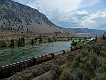 Interestingly, this area of the country is quite arid, not lush and green like the region we have been driving though. It is much like the high deserts of eastern Washington and Oregon. We are guessing the high coastal range just west of here does a very good job of stopping much of the moisture before it gets here. Interestingly, this area of the country is quite arid, not lush and green like the region we have been driving though. It is much like the high deserts of eastern Washington and Oregon. We are guessing the high coastal range just west of here does a very good job of stopping much of the moisture before it gets here.
We got stopped once for road work which worked out well as we both needed a break. Having a bathroom available when you need it sure is handy. There were many times on the bikes we would get stopped like this, but had no facility. This is quite civilized. Verna also took the opportunity to take a photo, capturing 2 trains heading in opposite directions on either side the river (photo right).
|
|
It was still early afternoon when we got to 100 Mile house so decided to press ahead. We finally stopped a little north of Williams Lake where we are back in the heavily forested landscape, with trees for miles in every direction. Lumber is obviously a big business up here.
With lots of daylight left, Verna decided to go for a bike ride. It started out with a 10 minute downhill descent of 600 feet in altitude along the highway. Then a dirt road for about 6 miles that was relatively level (comparatively) as it followed the valley in an Indian reservation. Then back on the pavement, an uphill climb of 700 ft in about 6 miles, then a short drop back into town. Whew!
The campground had a nice laundry facility so we took advantage of that and spent the rest of the evening doing laundry. Isn’t this fun!?!?
When Verna was removing the sheets, one ripped and we found that the support board for our mattresses has come loose from the hinge that holds it in place. Further investigation proved that the design was faulty and we need to get some furring strips to serve as a cleat to support the board or it will continue to come apart.
|
Saturday, June 13, 2009
|
Williams Lake, BC to Vanderhoof, BC
|
Today's statistics:
Total Distance: 321 Km
Travelogue Total: 1771 KM
Average Speed: 76.1 KM/H
Total Time on Sidecar/Truck: 4 Hours 15 Minutes
Verna awoke this morning the the whining drone of a mosquito in her ear (but not for long!). It was light outside and it was only 3:45 am! Luckily she was able to get back to sleep, but these short nights will take some getting used to. It doesn’t get really dark until after 11 pm.
We have had wonderful luck with the weather. It rained a bit last night (thankfully after the laundry was done) but was clear this morning with dry roads.
It was an uneventful day, just kilometer after kilometer, rolling down the highway. We arrived in Prince George about noon and filled up with fuel. Interestingly, the fuel here is only a few cents more per liter than it was in Hope. We are suspecting that the prices are a bit more regulated than they are in the US. It is somewhat nice not being gouged out in the middle of nowhere because there are no other options.
On the way out of town, we passed a Costco and had to stop for fresh fruit and meat. Prices are considerably higher than the states, but the Costco price is still much better than the smaller stores.
We stopped early today in Vanderhoof. Wanted to go for a walk in the evening but didn’t want to dare the mosquitos that were swarming at the screens. Honestly, there were a dozen or so at each window, trying to get in. Finally we sprayed the screen with mosquito spray and that kept them away. At least we could open the screen door to get the outside door closed for the night!
We had internet access so did some investigation on the road we were planning to take north from here. There are 2 sections that are still gravel and we were concerned about those. But the highway department reported they were still working on a large mud slide that closed the road. Traffic was open one way at a time, but we decided we didn’t really want to go slogging through the mud while towing a trailer. So we will take the 97 route toward Dawson Creek instead.
|
Sunday, June 14, 2009
|
Vanderhoof, BC to Chetwynd, BC
|
Today's statistics:
Total Distance: 406 Km
Travelogue Total: 2177 KM
Average Speed: 77.6 KM/H
Total Time on Sidecar/Truck: 5 Hours 15 Minutes
|
|
Another gorgeous day as we hit the road to backtrack to Prince George to follow the other route. We are really thankful for all this wonderful weather as it makes traveling so much nicer.
Lots of beautiful scenery, but there is truly a lot of wilderness out here. Occasionally we pass a small settlement, or a lonesome house, and marvel at the tenacity of the people who live this far outside of civilization. We can only assume that they enjoy being in the middle of the forest with lakes and rivers all to themselves. Hmm, sounds kind of nice, doesn’t it? Until you need a quart of milk...
We are not getting as good fuel mileage as a few days ago. The terrain is getting much more challenging with lots of hills to go up and down.
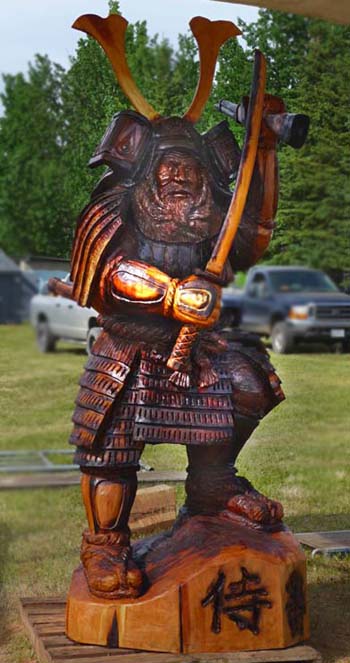
We decided to call it quits at Chetwynd tonight. There is still enough time for Verna to go for a bike ride and the weather is holding well. Verna discovered on her ride that today is the final day of the annual chainsaw sculpture contest. Contestants come from all over Canada and the US to compete. The sculptures become the property of the Chamber of Commerce who places them all over town. You can take a walking/driving tour to see the results from the last 5 years. It really is quite amazing. Chainsaw art has come along way! The photo at left is just one example of this year’s offerings.
The bike cover had another rip today so Verna took advantage of the good weather to set up shop on the picnic table (this is not an indoor activity!). She got the cover repaired (it is becoming quite a patchwork) and added some foam to hopefully prevent it from happening again.
|
Monday, June 15, 2009
|
Chetwynd, BC to Fort Nelson, BC
|
Today's statistics:
Total Distance: 511 Km
Travelogue Total: 2688 KM
Average Speed: 75,9 KM/H
Total Time on Sidecar/Truck: 6 Hours 43 Minutes
Yes, we are still in British Columbia. It is a very long province and takes a while to negotiate. We took a “shortcut” this morning to avoid going into Dawson City. This took us into a beautiful area along the Peace River that is not well traveled (but the road is in great condition). Along the way, we saw 2 deer early on, then a bit later saw a mother moose and her very young calf along the verge. The road climbs quite steeply to rise above the river and from here you get a fantastic view (photo below).
|
|
|
|
There were a couple of more steep inclines and toward the end there was a gravel mine, so we got to follow the gravel trucks up the last steep incline (not that we could have pulled it that much faster :-). It was a beautiful diversion and a lot less congested than Dawson City.
Shortly after joining the Alaska Highway, Jim spotted a black bear along the side of the road. We later saw a mother and her cub, than saw another lone bear a few hours later.
The first part of the drive on the Alaskan Highway we were spiriting right along as the road surface was in excellent condition with very little traffic. We stopped for lunch in Wonowon (it is located at milemarker 101). Then, just as we were commenting on how well the road was maintained, it turned very rough. At times we slowed to 35 mph as we bucked along. Thankfully that lasted only about 5 km, then it got reasonable (but not great) again.
|
|
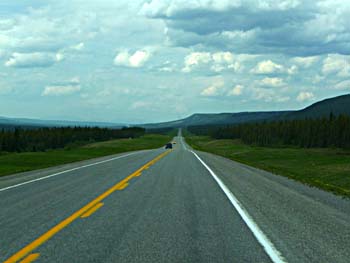 Just before Pink Mountain (mile 143), we began climbing long hills then descending into deep valleys, only to repeat over and over. There goes the mileage! Some got quite steep, both up and down. The second half of the drive to Fort Nelson was more level with some very long, straight stretches (photo, left). We also noted they were mowing the roadsides. It appears they try to keep a transition zone between the forest and the road, presumably to keep the animals away from the road, as well as facilitate the drivers’ ability to see them. Just before Pink Mountain (mile 143), we began climbing long hills then descending into deep valleys, only to repeat over and over. There goes the mileage! Some got quite steep, both up and down. The second half of the drive to Fort Nelson was more level with some very long, straight stretches (photo, left). We also noted they were mowing the roadsides. It appears they try to keep a transition zone between the forest and the road, presumably to keep the animals away from the road, as well as facilitate the drivers’ ability to see them.
We thought about stopping sometime before Fort Nelson, but there wasn’t much out there and there was plenty of daylight yet, so we pressed on. We got in and set up in plenty of time to walk to the store and back before the thunderstorm hit. It rained pretty hard for a while with thunder and lightening, so we were very happy to be in our cozy little home.
|
|
Tuesday, June 16, 2009
|
Fort Nelson, BC to Watson Lake, YT
|
Today's statistics:
Total Distance: 517 Km
Travelogue Total: 3205 KM
Average Speed: 62.1 KM/H
Total Time on Sidecar/Truck: 8 Hours 10 Minutes
We woke to the pitter-patter of rain on the roof and it stayed with us as Jim cleaned and put away all the muddy hook-up paraphernalia, fueled up, and headed down the road. As we were one of the later departures, most all the traffic was well ahead of us and we encountered very little traffic.
Today began our serious westerly movement across BC. The first 80 or so kilometers were fairly flat with only a few rough sections of road that slowed us a bit. Just after Steamboat we began to climb from 1500 feet in elevation to 4250 feet at Summit Lake (mile 392). This is the highest pass on the Alaska Highway.
|
|
 We rolled along, rising and descending along the hills in a fairly straight path. At one point near summit lake we descended an 8% grade over 2 km. Thank goodness for a manual transmission. We then entered some curvy up and down bits that led us to believe we were driving on a portion of the original road. A bridge rebuilding work effort stopped us for a while, but the temporary surface was a pleasant surprise as it was quite well graded and still wet from the morning rain. It had now stopped raining and shortly thereafter we stopped for lunch at Toad River. We rolled along, rising and descending along the hills in a fairly straight path. At one point near summit lake we descended an 8% grade over 2 km. Thank goodness for a manual transmission. We then entered some curvy up and down bits that led us to believe we were driving on a portion of the original road. A bridge rebuilding work effort stopped us for a while, but the temporary surface was a pleasant surprise as it was quite well graded and still wet from the morning rain. It had now stopped raining and shortly thereafter we stopped for lunch at Toad River.
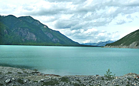
Just after lunch we drove by Muncho Lake where we were stopped for a short bit while they dumped some rocks (big rocks) over the road edge to shore up the road. The lake is rather large and the most beautiful aqua blue. The picture (above) does not do it justice.
|
|
 The afternoon’s ride was full of mountain views in every direction. After stopping for road work at Muncho Lake, the drive got easier as we followed the valley along the river. The road was in fairly good condition with a few rough spots so we made pretty good time. We suspect that this is a rebuilt section of road as it is wider and follows the natural terrain less than the portion earlier today. There was even a passing lane at one steep point. The afternoon’s ride was full of mountain views in every direction. After stopping for road work at Muncho Lake, the drive got easier as we followed the valley along the river. The road was in fairly good condition with a few rough spots so we made pretty good time. We suspect that this is a rebuilt section of road as it is wider and follows the natural terrain less than the portion earlier today. There was even a passing lane at one steep point.
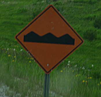
One warning sign that is very important to pay attention to is the one for rough road ahead (photo left). They are generally well placed to prepare you for a bumpy bit ahead. Sometimes there is even a warning sign or flag right next to the rough spot, at road level. Look for these and slow down. They mean it!
|
|
We were surprised that we had seen no wildlife, yet had seen warning signs for deer, horses, caribou, and bison. But about 4 pm we saw a group of 4 male bison along the side of the road. Just before Watson Lake we spotted another 2 bison and then a black bear.
|
|
|
|
And yes, we finally made it to the Yukon Territory. The town of Watson Lake is small, but well known for its “Sign Forest.” This is an area where the workers on the original road left signs indicating where they were from. Over the years it has gorwn to about an acre of signs from visitors from all over the world. Many have left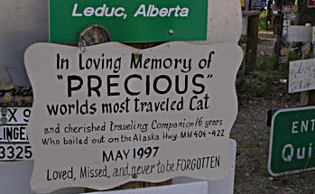 city signs, lots of license plates, business signs, and simple homemade signs indicating who has passed through. We noted that other than the US, Germany seems to be the best represented country. It is interesting to wander among the signs, seeing where people have come from to visit. The photo above shows Jim standing in the forest. city signs, lots of license plates, business signs, and simple homemade signs indicating who has passed through. We noted that other than the US, Germany seems to be the best represented country. It is interesting to wander among the signs, seeing where people have come from to visit. The photo above shows Jim standing in the forest.
One very touching sign was left by a caring family (photo, right):
|
|
The sun was just above the horizon as Verna was heading to the showers at 10:30 pm! It is now 11 and still daylight out. Pleasant dreams...
|
Wednesday, June 17, 2009
|
Watson Lake, YT to Whitehorse, YT
|
Today's statistics:
Total Distance: 425 Km
Travelogue Total: 3630 KM
Average Speed: 64.7 KM/H
Total Time on Sidecar/Truck: 6 Hours 43 Minutes
Another long driving day today. We toy with the idea of not traveling so far each day, but that tends to leave you in the middle of nowhere. And there is a lot of nowhere out here! So it just makes sense to put in the miles (kilometers) and get to a good stopping place.
Today didn’t have a lot of elevation gain as we were usually between 2500 and 3300 feet. Lots of gentle rises and descents as we rolled our way across the landscape. Hopefully we will improve our gas mileage over yesterday (8.4 mpg, the lowest we have ever gotten).
|
|
|
|
The photo above was taken just before Rancheria (mile 710) as we got our first good view of the distant mountains. You can see the road is relatively level and in decent condition. However, as you follow the road, you can just see the dust cloud over the trees where there is road construction. And yes, it was very dusty driving through it for several miles. Luckily we passed few vehicles coming the other direction as they are the ones that tend to throw rocks. The roads are basically tar and gravel, so after they finish a section, a lot of loose dusty gravel remains.
|
Thursday, June 18, 2009
|
Whitehorse, YT to Skagway, AK
& Return
|
Today's statistics:
Total Distance: 372 Km
Travelogue Total: 4002 KM
Average Speed: 47.5 KM/H
Total Time on Sidecar/Truck: 7 Hours 48 Minutes
Today we jumped on the bike and ventured to Skagway. The route generally follows the route the stampeders followed as they got off the ships in Skagway and made their way over the pass to Whitehorse, then followed up the river to Dawson City.
 Driving through this rough terrain we continue to marvel at the fortitude of those who made the journey. By vehicle, it is about 14 miles to the pass. This is coming from sea level at Skagway to 3400 feet at the pass. Plus, these people were bringing all their supplies, including a year’s worth of food, as required by the Mounted Police. The current highway roughly follows the White Pass trail from Skagway. The alternate route from Dyea parallels this route but is just as steep and dangerous. Today you can hike the Chilkoot trail like the stampeders did from Dyea to Bennet (33 miles). We took a pass on that adventure. Driving through this rough terrain we continue to marvel at the fortitude of those who made the journey. By vehicle, it is about 14 miles to the pass. This is coming from sea level at Skagway to 3400 feet at the pass. Plus, these people were bringing all their supplies, including a year’s worth of food, as required by the Mounted Police. The current highway roughly follows the White Pass trail from Skagway. The alternate route from Dyea parallels this route but is just as steep and dangerous. Today you can hike the Chilkoot trail like the stampeders did from Dyea to Bennet (33 miles). We took a pass on that adventure.
|
|
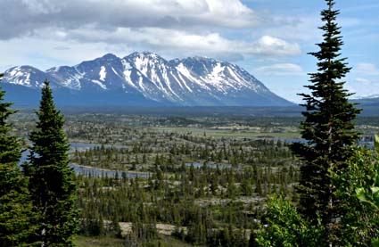
 Much of the first half of the trip today was over gently rolling terrain, first through grassy woodlands, then opening up into rocky plateaus with many lakes. The steep mountains yet to come can be seen in the photo above, left. Toward the end of the ride we spotted a black bear along side the road. He stood up on his hind legs, then turned toward us as he heard us approach. Jim slowed so Verna could get a picture, but as we neared, the bear turned tail and ran into the woods. And Verna missed the shot. Much of the first half of the trip today was over gently rolling terrain, first through grassy woodlands, then opening up into rocky plateaus with many lakes. The steep mountains yet to come can be seen in the photo above, left. Toward the end of the ride we spotted a black bear along side the road. He stood up on his hind legs, then turned toward us as he heard us approach. Jim slowed so Verna could get a picture, but as we neared, the bear turned tail and ran into the woods. And Verna missed the shot.
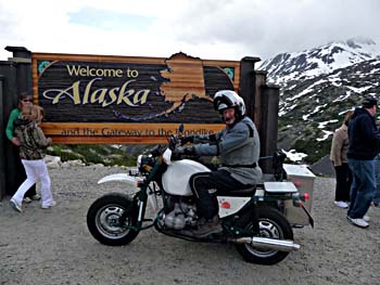
Later came the climb to the summit (3292 feet) of White Pass which marks the border to Alaska. Here we stopped for a quick photo with Jim and the bike at the “Welcome to Alaska” sign (photo right). We had to work our way into the crowds of tour bus folks, so we didn’t take the time to get of shot of both of us. From here, it is pretty much a downhill run into Skagway.
|
|
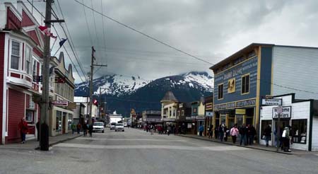
Skagway is a small town, nestled at the base of the mountains. It has a good port that today can manage several large cruise liners (today there were 4 large and one small liner in port). The town has many buildings from the early 1900’s and it retains its frontier charm. There are lots of jewelry, craft and clothing shops, plus a few souvenir shops. The quality of the items appeared to be very good, but the prices, as expected, were quite high so we didn’t buy anything other than a moose sticker for the bike. However, we did enjoy a nice hot bowl of salmon chowder and a green salad at a local eatery. The tab plus tip was $20 CDN.
|
|
Friday, June 19, 2009
|
Whitehorse, YT
|
|
 Today's statistics: Today's statistics:
Total Distance: 0 Km
Travelogue Total: 4002 KM
Average Speed: 0 KM/H
Total Time on Sidecar/Truck: 0 Hours 0 Minutes
Today was an R&R day. We have been traveling some long days, day after day for over a week now and it is time to slow down. So we decided to take a day to go nowhere. This allows us the time to do the laundry and work on the website. Jim was also able to fix the beds.
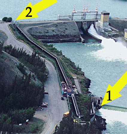
Verna took a ride into town and checked out the fish ladder, the longest wooden fish ladder in North America. The photo at right shows an aerial view of the ladder, the only way to see the whole thing. The fish enter at arrow #1, make their way up the switch-back, through the visitor viewing station, then all the way up to the dam at arrow #2.
The town has built a Millennium Trail, a bike/walking path that meanders along the river through the woods. The path goes along both sides of the river from the town to the fish ladder, providing town folks and visitors alike with a pleasant fresh air experience.
The dam is a large earthen dam that not only controls the water flow, but also provides the area with electricity.
|
Saturday, June 20, 2009
|
Whitehorse, YT to Haines Junction, YT
|
Today's statistics:
Total Distance:
Travelogue Total:
Average Speed:
Total Time:
|
Truck:
161 Km
4163 KM
48.1 KM/H
3H 15 Min
|
Sidecar:
169 Km
4163 KM
70.6 KM/H
2 H 23 Min
|
|
|
|
& a portion of the Haines Highway
|
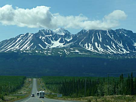 A mixed day for us today as we traveled from Whitehorse to Haines Junction and set up camp by early afternoon. Several sections of the road were somewhat rough today, forcing us to slow down to 50 for significant distances. A mixed day for us today as we traveled from Whitehorse to Haines Junction and set up camp by early afternoon. Several sections of the road were somewhat rough today, forcing us to slow down to 50 for significant distances.
We stopped at a rest stop and saw a family who was evidently moving to Alaska, The teenage boy saw Jim’s phone on his belt and asked him “When do the phones start working?” We guess all this wilderness with no phone infrastructure was getting a little much for him.
At the last rest stop, we met a gentleman from Alaska who warned us that the road from Haines Junction to Tok was even worse. We also talked for some time to 2 couples traveling together on their second trip to Alaska. Jim and the guys talked truck, bike and road stuff while Verna and the women discussed food adventures and places to see. Shortly after leaving the rest stop we got a great view of the upcoming mountains in the distance. The 2 rigs in front of us are the 2 couples we met.
|
|
We got into camp early, so went to the visitor center then had some lunch. We got on the bike and headed south on the Haines Highway for about 80 km before returning. While the road leads all the way to Haines, we didn’t have time to go that far. The scenery was beautiful as we drove along the Kluane National Park. However, we did ride on some of the smoothest pavement we have seen for over a week. Too bad it didn’t last!
|
Sunday, June 21, 2009
|
Haines Junction, YT to Tok, AK
|
Today's statistics:
Total Distance: 291 Miles
Travelogue Total: 2678 Miles
Average Speed: 35.6 KM/H
Total Time on Sidecar/Truck: 9 Hours 33 Minutes
Yes, we finally made it to Alaska! And as of today we are back to recording distances in miles.
We left Haines Junction early as we had heard the road was not in good condition from Haines Junction to Tok. So we planned to drive only to Beaver Creek today and then drive to Tok tomorrow. As reported, the road was okay up to Kluane Lake. We were able to manage 50 mph to the lake. And the lake is beautiful and very large. The picture below was taken at the south end of the lake just past Silver City.
|
|
|
|
Just past here, we ran into our first major road construction: 8 kilometers of dirt/gravel along the lake. The surface was so washboarded that for much of it we traveled at only 10 mph while others flew past us. But for us, the risk of breaking something is just not worth trying to make better time. After the construction we were able to do 35-45 mph for about the next 80 kilometers until we stopped for lunch. We managed this for a while after lunch until the next construction zone where we were able to do about 20-30 mph for 5 kilometers. We could then do 50-60 until a while later when was another construction zone of about 5 km.
Mid-afternoon we lost our satellite radio reception at about the 62nd parallel. We tried several times later as we altered course, but it appears we are too far north.
The last part of the road to Beaver Creek was in good condition and it was still early when we got there, so decided to press on. We took a break to eat the last of the fresh fruit before the border, then headed to Tok. After the border here was a stretch in the hills where we could only do 35-45 mph. After Northway Junction there was new pavement and smooth road that allowed us 50-55 mph most of the way to Tok. We got in about 5 pm (and we gained an hour), then spent about an hour washing the trailer before set up camp. We also noted that people were talking on cell phones, so checked ours and sure enough, we had a signal. This is the first phone service we have seen in many days. So now we know the answer to the question “When do the phones start working?” The answer is Tok.
|
Monday, June 22, 2009 - Tuesday, June 23, 2009
|
Tok, AK
|
Today's statistics:
Total Distance: 0 Miles
Travelogue Total: 2678 Miles
Average Speed: 0 KM/H
Total Time on Sidecar/Truck: 0 Hours 0 Minutes
We are rewarding ourselves for the long push by staying here in Tok for 2 days and not going anywhere. Verna took a nice long bicycle rode and Jim worked on the water pump and got the truck washed. Both of us are enjoying the time to relax and get a few things done.
|
|
Stay tuned for further adventures...
|
|
|

