 |
|||
|
We finally took off the day after Christmas, even though the weather report showed another storm moving along the southern coast of Spain and North Africa. Luck was with us as we sped along the northern edge of the storm (in the sunshine) almost all the way to Almeria. Once we settled in we set out for a walk through town, enjoying the early evening stroll with the locals. Just after dark (and just after getting back to our room), it started raining and rained a good portion of the night. By morning there was a cloud bank over the Med, but blue skies overhead. What luck! After a filling breakfast of churros, orange juice and tea, he headed north toward Tabernas. This is the desert area of Andalucia and the place where the “spaghetti westerns” were filmed. It did look very much like southern California and parts of Arizona and Northern Mexico. They have preserved the movie sites and they are now a local attraction, complete with bank robbery and shootout.
We came back down out of the mountains toward the coast at Adra and found ourselves in the middle of a sea of plastic greenhouses. Hundreds of acres of greenhouses! We’ve never seen so many, nor would have believed it if we had not seen it. We guess this is what happens when the rest of Europe demands fresh red tomatoes and green beans all winter. As ugly as it is, it probably isn’t too harmful to the environment (except for the old plastic that is blowing about, hanging from trees and tangled in the bushes). The sea of greenhouses covers the coast from just east of Adra all the way to Almunecar. As we hit the coast, we also hit the wind. It was strong (30 to 70 MPH) and blustery for the entire afternoon, and we were headed into it most of the time. As we headed along the coast toward Malaga, we went through many tunnels. One was in direct alignment with the wind and was truly a wind tunnel. Our first clue was when we entered the tunnel, the wind become stronger, which we thought was unusual. Then it remained that strong all the way through. It felt as though we were being pushed backward. The scariest tunnel was one that exited onto a bridge over a gorge - the wind roaring through the gorge just about knocked us off the bikes. Jim’s bike moved over a good half lane, and Verna said she felt like someone had grabbed her by the shoulders and was shaking her. It was extremely difficult to keep our heads steady to even see where were were going. Not an experience we would like to repeat. We can hardly wait for Patagonia, based on what we have heard about the wind there. We arrived at Malaga just before dark and by pure luck, drove right up to the hotel without getting lost first! The wind seemed to have settled a bit, so we took our evening stroll, stopping by the supermercardo to buy rations for dinner. We were both exhausted from the ride. That night we were both awakened by the wind - it howled for most of the night. But the next morning there was quite a bit of sunshine so we decided to walk to the Gibralfaro - the old fortress on the hill that protected the port from 1487 to 1925. If you walk, it is a strenuous climb to the top - but you can also take the bus which is a lot easier. The fortress itself has been somewhat restored, but you can still see the original construction of the walls and walk along the ramparts for the entire perimeter. Below the Gibralfaro is the Alcazaba, the Muslim palace-fortress begun in 1057. Just below the Alcazaba are the ruins of a Roman theater, currently being excavated.
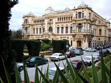
Further west is the Ayuntamiento (city hall), a grand building and garden complete with orange trees full of oranges. The view below left shows the town along the port looking west. At the lower part of the picture is the Ayuntamiento, shown in greater detail at right.
While the area east, north east of Malaga had been somewhat sparsely populated, the area from Malaga to Marbella more than made up for it! It was almost solid high-rises along the sandy beaches. A tourist haven, for those inclined to enjoy the hot sunny summer without regard to the thousands of others by your side. However, just south of Marbella, it seems to lighten up a bit and the high-rises are replaced by golf courses. We noticed there are now two signs that appear along this coast - one that has been there for a while: Costa del Sol, along with a newer one: Costa de Golf! Past Estepona, signs of humanity decrease dramatically and the highway wends it way south west, sometimes along the coast, other times cutting inland. There is far less traffic in this area, but the road is good and the sun was shining! About 4 hours later we begin to see signs of civilization again and found we were nearing La Linea, the border-town just north of Gibraltar. It is fairly nondescript town, but does have a nice harbor-side drive through town. Once you get near the border, you will see the traffic stopped and routed down a side road to avoid a backup on the main highway. We dutifully got in line with the rest and after a couple of minutes, the car behind us honked and the driver waved us on, explaining that motos don’t wait in line! OK, so we pulled around and passed all the traffic, pulling into traffic at the head of the line - what a deal! At the border they want to check your passports, so we pulled over to get them out and show them to the border guard. We put them away and drove 30 feet only to be stopped again for another check - the first was Spain, the second, Gibraltar. So don’t be too quick putting those passports away! Once in Gibraltar, the first thing you notice is that there is no place to park! The area is 5 km long and 1 km wide and only a small portion of that space is available for parking. We selected our hotel by finding the first One bike we noticed on our walks around town is shown here with some interesting jerry cans mounted up front. Now this chap is definitely prepared to go off road. It’s a Honda 600 dirt bike with specially made racks to which the Jerry Cans are mounted - one on each side. It also has Touratec Aluminum Luggage. Note the knobby tires for off road use. And shopping was the number two pastime for tourists, second only to touring the rock. The shopping was a surprise to us, but a pleasant one as there is no VAT or IVA tax. Jim was able to find the phone he was looking for at a great price and without the need to purchase a plan. So we now have a phone that can be used both in the US, Asia and Europe. Finally!
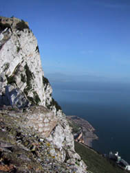
The view from the top gives you a good perspective on the peninsula. Below left is a view from inside the tunnels, toward the Spanish city of La Linea. You can just see the water’s edge on both sides so you can see how narrow the strip of land really is.
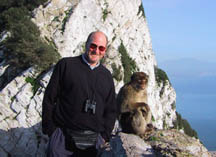
The picture below right is taken from the same place as the one above with Jim and his friend looking to the East. Just below this is a large expanse of rock that was used for hundreds of years to capture rain water and funnel it into huge cisterns which are still in use today for potable water in Gibraltar. The only difference is that today desalinization plants are generating the fresh water and rain water is no longer used.
We also took the opportunity to jump across the straights to Tangiers. Unfortunately, we didn’t choose the best day for the trip. The ferry was running, but it was a rough trip as the wind was howling! On a good day, the trip on this jet boat would take a little over a hour. For us, it was almost two! And by the end, the majority were wrenching - luckily we were in the minority! We had purchased the tour along with the ferry ticket so when we got to Tangiers, we were met by a guide at the port, pictured at right, who ushered us through the border by taking our passports, promising to return them before we boarded the ferry again. We got on a small bus and were driven to the Cazbah and Medina. The Casbah was the fortress to protect the port, and the Medina was where everyone lived, protected by the Casabah.
At 2 PM we headed back to the ferry via a scenic drive through the “rich” neighborhoods. At the dock, we did indeed get our passports back. While waiting to board the ferry, we were watching the port police checking the lorries boarding the ferry next to us. The policeman drug two young men out from the undercarriage of a lorry and handcuffed them, right hand to right hand. They were trying to smuggle themselves into Spain, but didn’t make it this time. Luckily the ride back to Gibraltar was a lot smoother than the morning’s crossing, but was still a bit dicey as we surfed the swells with a strong side wind. Once we thought we were done for when surfed down one swell and buried the right side of the bow as we felt the left aft quarter rise with the following sea and wind. Luckily we soon righted none for the worse. We stayed in Gibraltar for New Year’s eve, but not much was happening. There was no organized fireworks, but the locals were making up for it. Gave us a real warm feeling when the guys outside the local pub were lighting most of them! Emergency marine flares seemed to be one of the favorites - we figure they were firing all the flares that were close to their expiration date.
We then headed north along the Atlantic coast, a beautiful drive this time of year because of the lack of traffic. At first there a few small tourist areas, complete with a few small hotels and camping areas. Then the road heads inland a bit and we were treated to sweeping green valleys and low rolling hills dotted with oaks. As we neared Cadiz, the number of built-up areas increased as did the clouds. Cadiz is a small (but packed) town at the end of a long peninsula. The drive out the peninsula reminded Verna of the strand south of Del Mar near San Diego, California: The surf and dunes on one side, the road down the middle, the railroad tracks and the bay on the other side.
Once we arrived and found our hotel, we took a walk around town and as soon as we returned to our room, it started raining - good timing! Below right is a view of the sky as we looked out of our hotel room.
|
|||
|
If you find typographical errors or have any other problems when looking at the site please contact the Webmaster describing the problem and the page involved. |
|||
|
Copyright © 2000-2009 Jim Seavey and Verna Norris All Rights Reserved |
|||
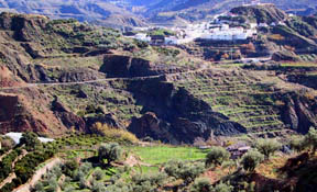 We then headed west through the Alpujarras - a beautiful mountainous area dotted with small white villages. We have no idea what these people do for a living, but would suspect it is either agricultural or raising animals. There were quite a few olive trees, so that may be their main means of livelihood.
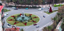
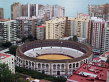 There are beautiful views of the city from the Gilbralfaro. Toward the port, there is the bull ring at the east end of the Paseo de Espana. The roundabout at that end of town was decorated with poinsettias for the holidays, including a large Christmas tree of poinsettias.
 We left Malaga, heading south along the coast toward Gibraltar. Our first mistake was missing the autovia - which meant we stayed on the local N340 which sluggishly moves along through every tourist town along the coast. Luckily it improves after about 30 km. At this point, caught the autovia which is a 4-lane highway without stoplights and roundabouts every 1/2 km.
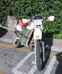 one to offer parking. When Verna asked where we could park, the clerk told us to park right in front of the hotel’s front door so they could keep an eye on them! You can drive around the peninsula and there is parking along the outer roads. The main roads through town are closed to traffic which is great for walking and shopping.
 We wanted to take the cable car to the top of the rock, but it was closed one day due to high winds, and we found it was closed on Sundays (so plan ahead). While at the cable car station, we were propositioned by an enterprising taxi driver, offering to take us up to the rock. Since we didn’t have much choice at that time, we accepted his offer. It was a bit expensive, but very nice. It was early Sunday morning, so we were just about the only ones on the rock. We visited the limestone caves (complete with a theater for concerts, plays, etc.), the tunnels, pictured at left, used during the great siege, and of course, we saw the Gibraltar apes. What do you think of Verna’s new found friend?
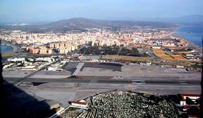 That mass of asphalt running across the center of the picture is the airport runway. And yes, all vehicle and foot traffic in/out of Gibraltar is stopped each time a plane takes off or lands as the main road runs across the runway.
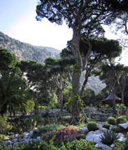 We were surprised to find a beautiful botanic garden in the middle of the area, pictured below left.
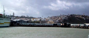 As we walked through the narrow, twisting walkways of the Casbah it was obvious this is not someplace you want to venture on your own - after the first two turns, you totally lose your sense of orientation. After the brief tour of the Casbah and Medina (complete with demonstration by the snake charmer), we were taken to a restaurant for lunch: vegetable soup, kebab starter, chicken and couscous for the entree, and a honey pastry for dessert with sweet mint tea. It was all very good and included in the price of the tour. After lunch we went to the shops and visited the rug shop (some beautiful works - Verna’s favorite was an 8x10 Four Season’s design for $3800 US - and no, she didn’t buy it!), a general gift shop with ceramics, woodworks, clothing, leather and brass, as well as a jewelry shop (we were saved from the spice shop because of time). For more information and pictures see our Tangiers page.
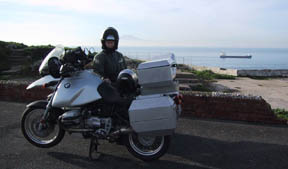
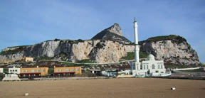 The next day we headed out of town, but before we left, we took the ride around the peninsula. On the point there is a mosque, left. Behind the mosque is, “The Rock”. Below right is Verna with the bikes with a view of the bay, looking toward Tarifa.
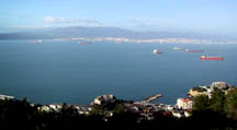
 We then drove around the bay and headed south toward Tarifa, the southernmost tip of Spain, and Europe. Algericas isn’t much to view, but does offer ferry trips to Tangiers and Cueta, the Spanish community on the north coast of Morocco. The picture below left was taken from the point where the mosque is located, facing to the right of where Verna’s is pictured with the bikes. It’s only 6 kilometers across the channel. This must have made for some interesting times when Spain was supporting France during the Napoleonic Wars when the British were using Gibraltar as their main support site for the Mediterranean area. There is also a BMW dealer in Algericas.
 Once past Algericas, there was not much traffic, nor signs of civilization. The road was in great condition and provided some wonderful vistas across the straights to Morocco. Tarifa is a small town with windsurfing being its greatest claim to fame. There is also a ferry to Tangiers from there.
 After Cadiz, we headed east toward Arcos de la Frontera, where we stopped for lunch (fish soup, roasted turkey legs, and fries) just outside of town. We then drove on to Ronda where we stayed the night. This picture was taken as we neared Ronda, showing the town on the top of the hill. Unfortunately the picture does not do justice to the view. See the section titled “Pueblos Blancos” for a picture taken from the town to obtain a better perspective of the heights involved.
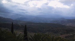 It was still raining the next morning, so we took our time getting up and packed as we knew we had a 4000’ pass to get through. The good news was that the rain allowed us to discover were the water was getting into all four of our Jesse panniers (see the Equipment Report Card for more info on this). We left just before noon and enjoyed a leisurely trip to the coast with only a little bit of rain in the beginning. By the time we reached the coast, it was actually quite warm and needed to shed some clothing. This time coming into Malaga, we stayed on the autovia the whole way and it was much more pleasant than the trip out!
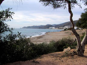 We came into Almeria expecting to stay the night, but found the hotel in the port full! So we headed out to Mojacar. On the way we passed the Paris-Dakar vehicles headed toward Almeria. Unfortunately, we didn’t figure out that’s where they were staying until after we got to Mojacar and read the newspaper. It would have been great to have seen the bikes, cars and trucks up close. However, the choice to stay in Mojacar was a good one as it is a small area on the coast that has no high-rises! It was quite a nice change. It is a way off the beaten path, so it is not someplace you would find accidentally. As you can see in the picture, you can actually walk along the beach without being assaulted by high-rises and concrete.